Kolanin Mountain
Kolanin – a peak at 706 m a.s.l.in the western part of the Low Beskid Mountains. It is located on a side ridge of the Magura Wątkowska Range, in its southeastern part. Kolanin’s southeastern slopes descend steeply to the Kiczera Stream, its northern slopes descend to the Ryj Stream, and to the west it borders Ostrysz Peak (635 m above sea level).
Kolanin is composed of sedimentary rocks formed millions of years ago on the bottom of a former ocean. It belongs to the Magura Nappe – the largest and highest structural unit in the Flysch Carpathians. It is formed by so-called flysch, alternating layers of sedimentary rocks. These are thick-bedded Magura sandstones, hard and highly resistant to weathering and erosion. These sandstones form the highest parts of the Kolanin ridge and are responsible for its steep slopes. Clay shales and marls, on the other hand, alternate with sandstones. They are much softer and more susceptible to erosion, allowing water to more easily carve valleys and passes (such as the nearby Hałbowska Pass).
Kolanin, like neighboring Świerzowa and Wątkowa, owes its height to the phenomenon of landform inversion. Tectonic-wise, this ridge is a syncline (i.e., a geological trough/concavity). However, because thick and exceptionally resistant layers of Magura Sandstone were deposited within this trough, erosion spared this area. Neighboring anticlines (protrusions), composed of softer shales, were eroded over time by rivers and transformed into valleys, while the hard Kolanin syncline remained in the landscape as a high, steep mountain ridge.
Kolanin’s summit is forested, covered by a primary lower montane forest. On the southern side of the peak, a small clearing offers views of the Slovak peaks of the Low Beskids and the Czerchowskie Mountains.
The slopes of Kolan are covered with Carpathian beech forest, composed primarily of European beech, silver fir, and sycamore. Its undergrowth consists primarily of glandular honeysuckle, snowdrop, bear’s garlic, and wood anemone.
In the upper reaches of Kolanin, where the soil becomes poorer, sandier, and more acidic, the fertile beech forest gives way to acidic mountain beech. The stand is still composed primarily of beech, but the trees are shorter here, more bent by wind and frost.
On the western side of the peak, at an elevation of approximately 620 meters above sea level, lie the sources of the Ryj Stream. It flows initially northeast through the forested areas of the Magura National Park, then east, passing the villages of Jaworze and Desznica. It ultimately flows into the Wisłoka River as a left tributary in the village of Kąty. The very steep southern slopes of Kolanin are crisscrossed by a dense network of smaller, unnamed streams—headwater streams—and smaller streams that flow directly south. These feed the Krempna (Krempanka) stream and the Wisłoka River itself in its upper reaches, near the Krempna reservoir.
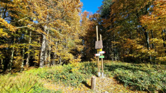
The red-marked Main Beskid Trail runs through the summit of Kolanin.
Hikes related to the object KOLANIN MOUNTAIN: