Łamana Skała Range
Łamana Skała Range – a mountain range in the eastern part of the Mały Beskid Mountains. It runs latitudinally from the Soła Valley in the west to the Skawa Valley in the east. To the north, it descends into the Silesian Foothills and to the south borders the Pewelsko-Krzeczowskie Ranges. From Madohora, westward, runs the long ridge of Wielki Gibasy Groń, descending to the Kocierzanka River in Kocierz Moszczanicki. From Potrójna, northward, runs the short ridge of Jawornica, descending to the Targaniczanka Stream in Targanice. From Groń Jana Pawła II, runs the long ridge of Gancarz, descending to the Wieprzówka River in Andrychów.
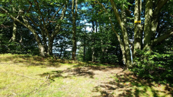
The summits of the Łamana Skała Range are covered with a lower montane spruce forest with a mixture of beech and fir. A truly unique natural site is a fragment of the upper montane spruce forest growing near the summit of Łamana Skała, at an altitude of approximately 900 meters above sea level, unusual for upper montane vegetation. The last natural Carpathian beech forest communities are protected within the Szeroka nature reserve in the vicinity of Cisowe Grapy and Zasolnica. The remaining area is dominated by mixed forests, including hornbeams, oaks, ash trees, wych elms, black alders, willows, birches, and rowans.
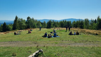
On the ridges and slopes, there are many former shepherd’s clearings, which are gradually becoming overgrown with forest as pastoral activity ceases.
The highest peaks of the range are Łamana Skała (929 meters above sea level), Madohora (910 meters above sea level), and Leskowiec (918 meters above sea level).
Hikes related to the tag ŁAMANA SKAŁA RANGE: