Łupany Dół
Łupany Dół – a gorge on the Krakow Bridge in the southwestern part of the Sowiniec Range. The gorge slopes southward in an arc, its left slopes forming the slopes of Pustelnik Mountain, and its right slopes forming the slopes of Ostra Góra and Srebrna Góra. It is approximately 1,100 meters long and flows into the Vistula Valley in Przegorzały.
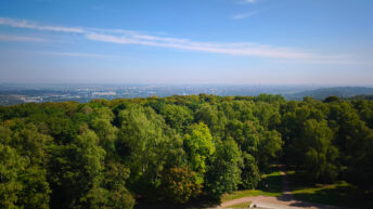
The Split Bottom is covered with a mixed forest, dominated by oak and beech. At the mouth of the gorge, on the slopes of Srebrna Góra, lies the Bielańskie Skałki Nature Reserve, established to protect the original xerothermic vegetation.
The North-South Chełm-Bielany Trail marked in red, the Wola Justowska-Pod Dębiną Wolski Forest Ravines Trail marked in yellow, the Piłsudski Mound-Zoo Circular Trail marked in blue, and the Splitting Hole Trail marked in black, the Polana pod Dębiną-Bielany Split Pit Trail, were marked through the gorge.
Hikes related to the tag ŁUPANY DÓŁ: