Wolski Dół
Wolski Dół – a long gorge on the Krakow Bridge in the northern part of the Sowiniec Range. The gorge slopes northeastward, its left slopes forming the slopes of the Sowiniec Mountains, while the right slopes form the slopes of the ridge descending northeastward from Pustelnik.
Wolski Dół is a Holocene gorge with steep sides and a flat bottom with a narrow terrace, composed of white gravel, sharp rock debris, and yellowish loess silt, formed by erosion of rocks and soil. In the lower part, Upper Jurassic limestones are exposed, which then pass continuously into bed limestone. Numerous karst channels, fractures, and crevices occur here. The upper part of Wolski Dół is primarily covered by loess. However, in some places, isolated rock formations can be encountered, characterized by a high degree of block disintegration.
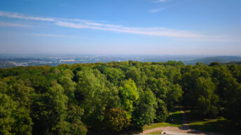
The gorge is mostly covered with natural forest. The old-growth forest here is represented by subcontinental oak-hornbeam forest, mixed coniferous forest, and Carpathian beech forest. Beech, oak, hornbeam, and pine predominate among the trees. The undergrowth includes wood anemones, yellow anemones, hepaticas, lilies of the valley, bracken ferns, and fernwort. Many protected species can be found in the gorge. Among them are the broad-leaved helleborine, the martagon lily, and the hollow corydalis.
The Panieńskie Skały landscape nature reserve has been established in the lower part of Wolski Dół.
The green-marked Two Mounds Trail (Salwator–Kryspinów) and the yellow-marked Wola Justowska–Polana pod Dębiną Gorges of the Wolski Forest trail have been established through the gorge.
Hikes related to the tag WOLSKI DÓŁ: