Tag - Burkův Vrch Mountain
Burkův Vrch – a peak at 1032 meters above sea level in the Moravian-Silesian Beskids in the Poloms Range on the border between the Czech Republic and Slovakia. It borders Muřinkový Vrch to the east and Čuboňov to the west. The southern slopes are drained by the Olešnianka Stream to Kysuce in the Váh River basin, while the northern slopes are drained by streams flowing into the Łomná River and further to the Olza River in the Oder River basin. The Black Sea and Baltic Sea watershed run through the peak.
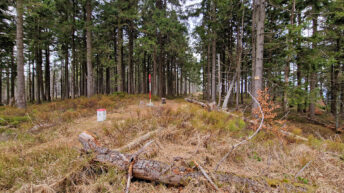
The peak is covered with a lower montane mixed forest, dominated by spruce and beech, with some fir. The summit has very steep slopes, and a small rock outcrop is located on the summit.
The summit is reached by a marked path along the Czech-Slovak border, marked on the map. The red hiking trail traverses the summit from the north.
Hikes related to the tag BURKŮV VRCH MOUNTAIN: