Tag - Gorc Range
Gorc Range – a mountain range that forms the eastern branch of the Turbacz ridge in the Gorce Mountains. It stretches for several kilometers from Turbacz to Gorc. It is characterized by a long, domed ridge, the height of which never falls below 1000 m a.s.l. Its peaks include Turbacz (1310 m a.s.l.), Trzy Kopce (1281 m a.s.l.), Kiczora (1282 m a.s.l.), Jaworzyna Kamienicka (1288 m a.s.l.), Średniak (1188 m a.s.l.), Przysłop (1185 m a.s.l.) and Gorc (1228 m a.s.l.). The northern slopes of the range descend steeply into the Kamienica Gorczańska stream valley, while several side ridges branch off on the southern side, between which lie the deep valleys of the Łopuszanka, Chłapkowy Potok, Furcówka, Forędówka, Jaszcze, Jamne, and Gorcowski Potok streams.
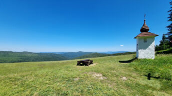
Sheep were once grazed in the upper reaches of the range. Many glades remain, the largest of which are: Hala Młyńska, Jaworzyna Kamienicka, Średniak, Przysłop Górny, Przysłop Dolny, Bieniowe, Gorc Gorcowski, Gorc Młynieński, and Gorc Kamienicki. These glades are currently located within the Gorce National Park. To preserve biodiversity, the park has begun mowing some of the clearings to prevent afforestation.
Hikes related to the tag GORC RANGE: