Tag - Pańszczyca Valley
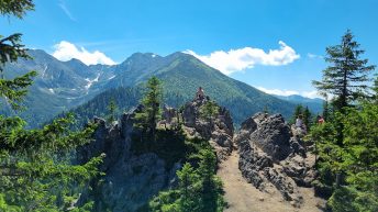
Pańszczyca Valley – a valley in the Polish High Tatras and the Reglowe Tatras, a side branch of the Sucha Woda Gąsienicowa Valley. The valley has an area of approx. 5.8 km², a length of approx. 6.5 km. In the south, it approaches a long side ridge of the Tatras, along which the Orla Perć trail leads from Skrajny Granat through Buczynowe Turnie to the Krzyżne Pass. The eastern slopes of the valley are formed by Koszysta, Rówień Waksmundzka and Suchy Wierch Waksmundzki, the western ridge extending from Skrajny Granat through the massif of Żółta Turnia and Skoruśniak into the forks of Sucha Woda Gąsienicowa and Pańszczycki Potok. The Pańszczycki Potok flows through the bottom of the valley, starting at an altitude of approx. 1600 m. The stream flows underground for a significant section.
The valley is mostly forested, and contains the following small swamps: Wyżnia Pańszczycka Młaka, Mała Pańszczycka Młaka and Wielka Pańszczycka Młaka. Higher up, the forest changes into a vast layer of lush dwarf pine growing among rocky debris. The upper part of the valley consists of glacial cirques arranged in steps, sent up by an ablation moraine. These are Czerwony Kocioł with Czerwony Staw Pańszczycki and the dry Żółty Kocioł. The high-mountain part of the valley is divided by unusually arranged ridges (because they run across the valley). One of them branches off from Żółta Turnia and ends with Mała Kopka (1793 m), the other from Waksmundzki Wierch and ends with Wielka Kopka (1855 m). The highest part of the valley is formed by a large scree called Zadni Usypy.
Hikes related to the tag PAŃSZCZYCA VALLEY:


