Tag - Bukowinki
Bukowinki – a peak with a height of 1218 m a.s.l., the third highest in the Sącz Beskid Mountains. It is located in the main ridge of the Radziejowa Range. From the north it borders Złomisty Wierch, the north-eastern slopes descend to Średni Stream, from the east through Długa Pass it borders the Mała Radziejowa peak, the southern slopes descend to Kotelniczy Potok and the western slopes to Stary Potok. The peak is a keystone for two side ridges diverging from it to the south. The shorter ridge with the Mokra peak (990 m a.s.l.) separates the Kotelniczy Potok valley from Czarna Woda. The longer ridge with the Świniarki peak (979 m a.s.l.) separates the Stary Potok valley from the Czarna Woda valley (in the lower part) and Kotelniczy Potok (in the upper part).
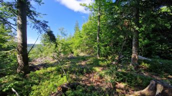
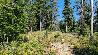
The peak is forested with an upper montane spruce forest. On the southern side, below the peak, the forest is very thin, revealing extensive views of the Gorce Mountains, Tatra Mountains, Pieniny Mountains, Levoča Mountains and Čergov Mountains.
On the southwestern slopes of Bukowinki, there is the Nad Kotelniczym Potokiem nature reserve, the aim of which is to protect the original fragment of the Carpathian forest of the lower montane in the form of a typically developed Carpathian beech forest. Above the reserve, there is the overgrowing Młaki Glade.
The peak is also called Bukowina, but both names are considered historical. Currently, according to the State Register of Geographical Names, the peak is called Złomisty Wierch Południowy.
Tourist maps indicate the peak’s height as 1,209 m a.s.l., but according to cartographic maps the peak’s height is 1,218 m a.s.l.
Hikes related to the tag BUKOWINKI:


