Tag - Łopusze and Kobyła Range
Łopusze and Kobyła Range – a mountain range in the north-eastern part of the Wyspowy Beskid, at its border with the Wiśnicz Foothills and the Rożnów Foothills. It has a roughly latitudinal course and stretches from the Trzciański Potok valley in Żegocin to the Białka valley in Wojakowa. In this range, looking from the west, there are the peaks: Górczyna (522 m a.s.l.), West Łopusze (661 m a.s.l.), Middle Łopusze (596 m a.s.l.), East Łopusze (612 m a.s.l.), Kamionka (594 m a.s.l.), Kobyła (603 m a.s.l.), Kopiec (585 m a.s.l.) and Szczełba (511 m a.s.l.).
The Wyspowy Beskid loses its “island” character on its northern outskirts and forms ranges. The Łopusze and Kobyła Range are about 18 km long. On the southern side, its slopes descend to the Trzciański Potok, Rozdzielec, Kamieński and Nagórski streams. In two places, it connects with the remaining peaks of the Wyspowy Beskid; through the Rozdziele Pass with Kamionna and through the pass between Kamionka and Jastrząbka. From the north, the conventional border is the Żegocina-Rajbrot road and the Uszwica river.
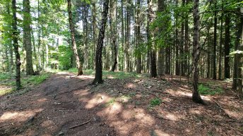
The range is covered with forest, on the southern slopes, farmland approaches the very peaks. The ridge is crossed by a blue and yellow hiking trail, and on the western side, they are joined by a green trail.
Hikes related to the tag ŁOPUSZE AND KOBYŁA RANGE: