Tag - Smrekovica Mountain (Branisko Mountains)
Smrekovica Mountain – the highest peak of the Branisko Mountains, at 1200 m a.s.l, is located in the northern part of the mountain range, in the Smrekovica range.
Smrekovica is located in the northern part of the main ridge, between the Branisko Pass and Kravcova (1,036 meters above sea level). To the north are Michalička (784 m), Ostrý vrch (863 m), Bučina (857 m) and Veľká skala (930 m), to the east Boldigaň (939 m), Kravcová and the hill Nad Bučom (1105 m), to the south Patria (1171 m), Rudník (1025 m) and Príkre (935 m), and to the west Petrova hora (1046 m), Skala (854 m) and Petruška (859 m). The southern part of the massif belongs to the Hornád Basin, where the Svinka River drains its waters, while the northern part flows down the Antalov Stream to the Torysa River.
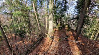
Up to an altitude of approximately 1,050 m above sea level, Smrekovica is covered with a lower montane mixed forest of beech and fir with some oak, linden, and pine. The upper montane forest above 1,050 m is dominated by a natural spruce forest.
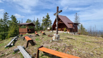
The peak is partially forested, revealing distant views in places. From there, you can see the surrounding peaks of the Branisko Mountains, as well as the neighboring Levočské vrchy, Bachureň, Čierna hora, and Volovské vrchy. In clear weather, you can also see the Slanské vrchy, Kráľovohoľské Tatry, and Vysoké Tatry.
The yellow hiking trail Vyšný Slavkov – Kravcová and the blue hiking trail Svätomariánska púť run through the peak.
Hikes related to the tag SMREKOVICA MOUNTAIN (BRANISKO MOUNTAINS):