Tag - Garlejów Groń
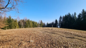
Garlejów Groń – a peak at an altitude of 728 m a.s.l. in the Pewel-Krzeczów Ranges. It is located in the central part of the Pewel Range between the Madeje peak from the west and the Gracówka peak from the east. The northern slopes are forested and the Grabski Stream flows down them, flowing into the Pewlica Pewelska Stream. To the south-east, Garlejów Groń forms a short ridge separating the valleys of two streams flowing into the Pewlica Jeleśnia; on the eastern side it is the Głęboki Stream, on the western side Mały Potok. This ridge is largely treeless, occupied by gradually overgrowing fields of the village of Pewel Wielka.
The peak is exposed from the south, thanks to which a vast panorama of the Żywiec-Orawa Beskid Mountains unfolds from it.
The yellow tourist trail Jeleśnia – Gachowizna runs through the peak.
Hikes related to the tag GARLEJÓW GROŃ: