Virtual hike: A hike through the Dalejów Reserve and Kamienna Góra, Poland
Route: Łysa Góra (324 m a.s.l.; 51.079140, 20.732623) – Dalejów Reserve (323 m a.s.l.; 51.075724, 20.730794) – Czerwona Góra (356 m a.s.l.; 51.063495, 20.751919) – Dalejów Depot (291 m a.s.l.; 51.059184, 20.772329) – Kamienna Góra (349 m a.s.l.; 51.064511, 20.786321) – Suchedniów, Kruk (310 m a.s.l.; 51.050498, 20.803634)
Trail designation: black trail, red trail, road marked on the map
Length: about 8.2 km
Walking time: about 2:20 h
Sum of approaches: 105 m
Sum down: 123 m
00:00:17 Łysa Góra
00:04:46 Monument to the Memory of Hunters and Foresters
00:06:54 Dalejów Nature Reserve
00:24:35 Crossing of trails
00:34:27 Crossing of trails
00:34:50 Monument to the memory of soldiers from World War II
00:35:48 Going off the trail
00:36:46 Czerwona Góra
00:38:17 Return to the black trail
00:51:08 The embankment of the former narrow-gauge railway
00:56:41 Crossing of trails
01:10:00 Going off the trail
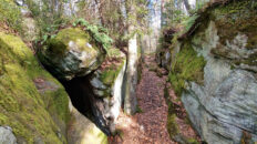
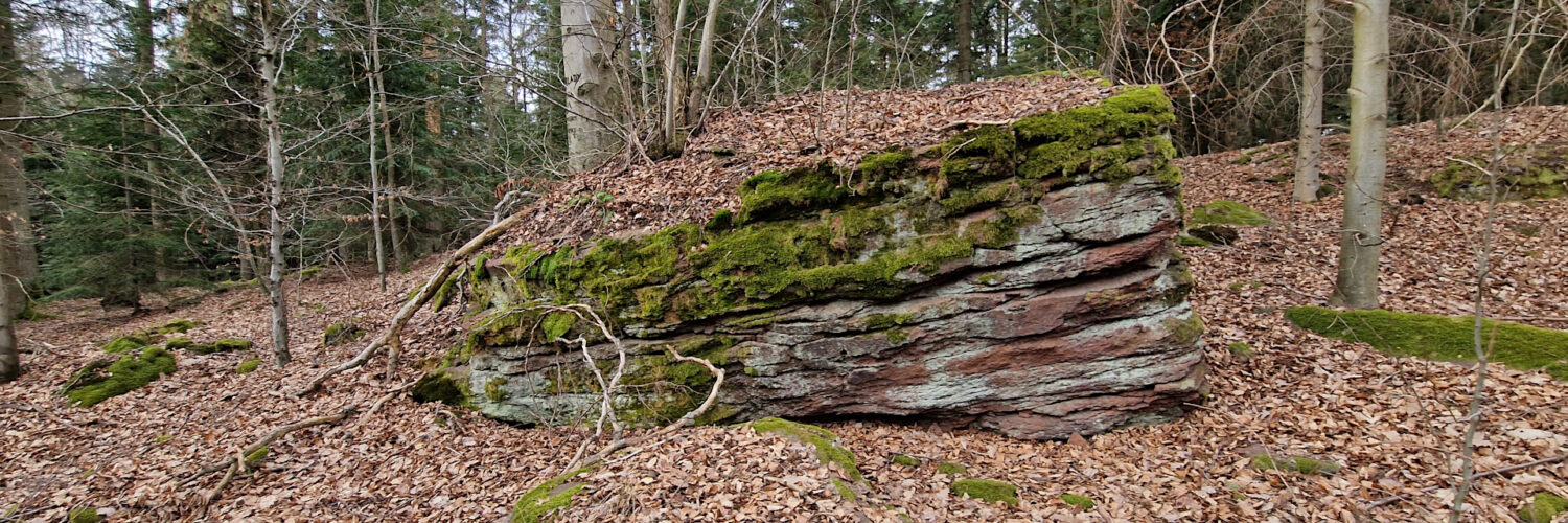
01:16:03 Kamienna Góra
01:18:14 Rocks
01:37:43 Black trail
01:57:10 Suchedniów, Kruk
Kamienna Góra (Suchedniów Plateau) – a hill 349 m a.s.l. in the central part of the Suchedniów Plateau. It is located in the Suchedniów-Oblęgorek Landscape Park. To the east it borders Szpic Hill, to the north it borders Czub Hill, to the west it borders Czerwona Góra Hill and to the south it borders Sucha Góra Hill.
The peak is completely forested, there are rocks made of white Triassic sandstone. To the south of the peak there are old stone mines. There is no tourist trail running through Kamienna Góra, you can get there by forest roads from the red tourist trail running a few hundred meters to the west of the peak.
The hike recorded on March 12, 2025.