Virtual hike: Ascent to Postawna Mountain from Bielice, Poland
Route: Bielice, forester’s lodge (730 m a.s.l.; 50.264316, 16.996644) – Nowa Biela (757 m a.s.l.; 50.259934, 16.989895) – Czarny Potok (792 m a.s.l.; 50.254446, 16.996882) – Biały Spław (940 m a.s.l.; 50.229466, 17.000656) – Długi Spław (995 m a.s.l.; 50.223296, 16.998746) – Pod Działem (1031 m a.s.l.; 50.220108, 16.995037) – Postawna Mountain (1117 m a.s.l.; 50.221937, 17.011852)
Trail designation: blue trail, path marked on the map
Length: about 8.5 km
Walking time: about 3:00 h
Sum of approaches: 393 m
Sum down: 29 m
00:00:36 Bielice, forester’s lodge
00:01:09 Biała Lądecka River
00:02:23 Crossing of trails
00:04:27 Biała Lądecka River
00:07:34 Crossing of trails
00:11:32 Bielawka Stream
00:11:59 Biała Lądecka River
00:12:17 Rów Morawski
00:15:26 Monument to the memory of Andrzej Krosta
00:17:30 Morawski Stream
00:17:37 Wiśnia Stream
00:19:06 Mała Wiśnia Waterfall
00:23:41 Biała Lądecka River
00:26:45 Czarny Potok
00:36:43 Biała Lądecka River
00:49:35 Biała Lądecka River
00:54:20 Biała Lądecka River
01:02:16 Jedlnik Stream
01:03:09 Biała Lądecka River
01:05:51 Działowy Spław
01:11:21 Biała Lądecka River
01:25:15 Biały Spław
01:26:28 Długi Spław
01:38:02 Długi Spław
01:47:42 Polish-Czech border
01:48:11 Pod Działem
01:52:06 Going off the trail
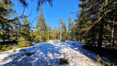
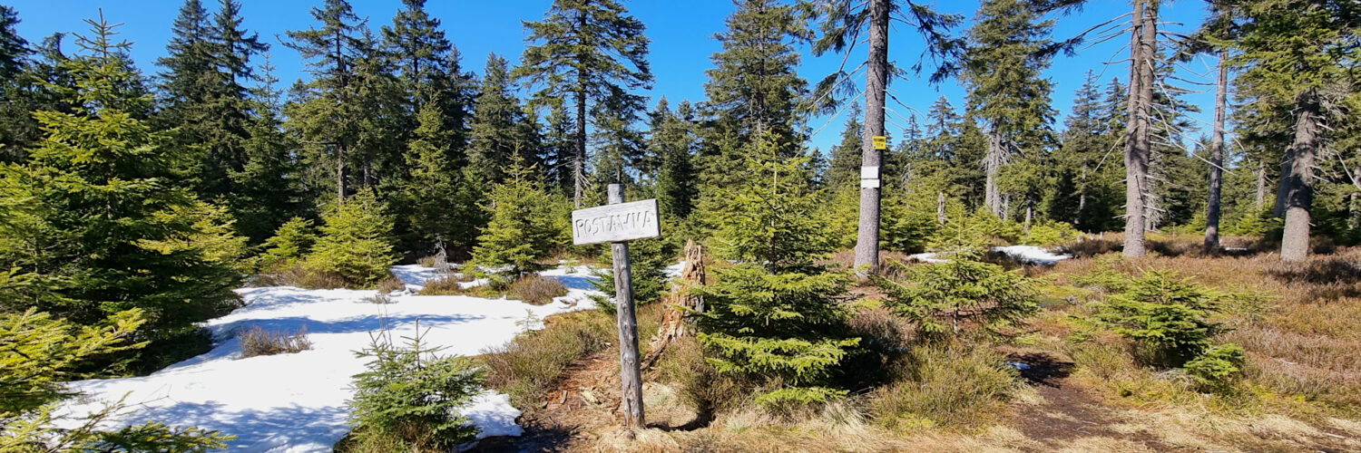
02:31:37 Postawna Mountain
Postawna Mountain – a peak at 1117 m a.s.l. in the Złote Mountains, in the Eastern Sudetes. It is the highest peak in the Polish part of the Złote Mountains. To the east, it borders the Brusek peak (1115 m a.s.l.) across the shallow Bielskie Siodło Pass. To the south, it borders the Travná hora peak on the Czech side. The northern and western slopes descend to the Biały Spław and Długi Spław streams, the main headwaters of the Biała Lądecka River.
The summit and its slopes, starting at approximately 900 m above sea level, are covered with an upper montane spruce forest. The summit itself is flat and offers no views.
There are no hiking trails leading to Postawna Mountain. The summit is located approximately 300 m from the Polish-Czech border. You can reach it by a poorly marked path from the border.
Hike recorded on April 3, 2025.