Virtual hike: Ascent to the Horodyszcze and Horodna hills, Poland
Route: Falejówka, cemetery (330 m a.s.l.; 49.622589, 22.153598) – Rzyczki Gorge (330 m a.s.l.; 49.618648, 22.158303) – Unnamed peak (473 m a.s.l.; 49.607074, 22.164316) – Niuchowa Hill (461 m a.s.l.; 49.611613, 22.168274) – Horodyszcze Hill (426 m a.s.l.; 49.597270, 22.186010) – Horodna Hill (367 m a.s.l.; 49.603041, 22.187464)
Trail designation: roads and paths marked on the map
Length: about 7.6 km
Walking time: about 3:00 h
Sum of approaches: 351 m
Sum down: 323 m
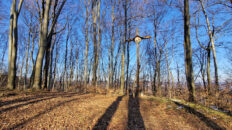
00:00:18 Falejówka, cemetery
00:04:24 Pijawka Stream
00:10:30 Rzyczki Gorge
00:47:42 Unnamed peak
01:03:15 Niuchowa Hill
01:53:26 Horodyszcze Hill
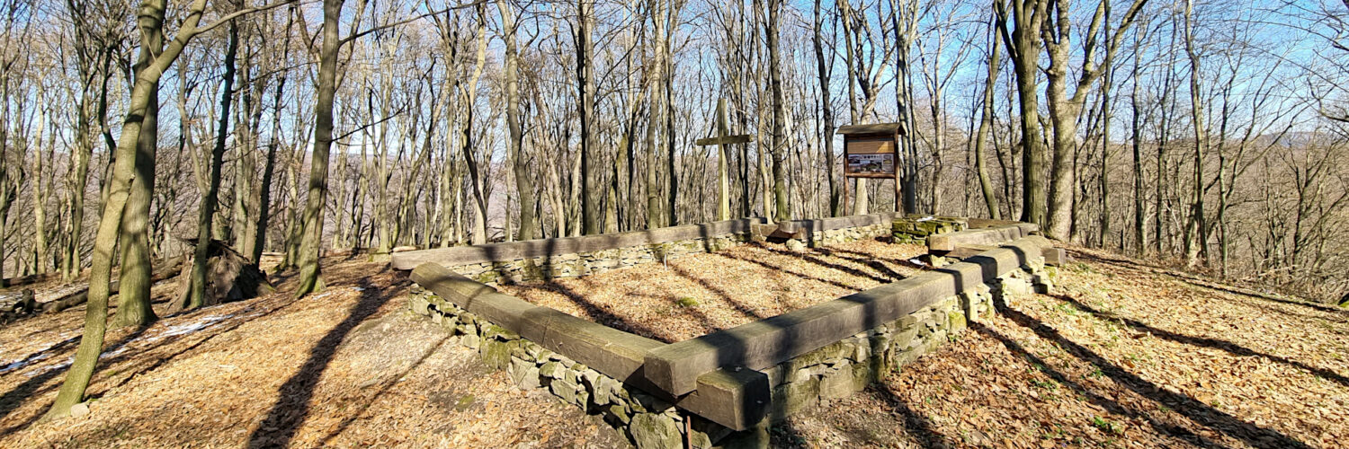
01:55:26 Ruins of an early medieval temple
01:55:50 The remains of an ancient stronghold
02:19:13 Stream
02:23:21 Stream
02:32:06 The remains of an ancient stronghold
02:35:56 Horodna Hill
Horodyszcze – a hill 426 m a.s.l. in the Dynów Foothills. It is located in the southern part of the foothills, in the Kopacz Massif, at the point of the greatest narrowing of the San valley. From the north it borders the Horodna hill, from the east the hill is flowed by the San River, the southern slopes descend to the town of Trepcza, to the north-west there is a ridge with the peak of Niuchowa.
The peak is covered with a submontane form of Carpathian beech forest, the slopes are overgrown with an urban forest characteristic of the foothills. From the top, in the gaps between the trees, a view of the San Valley is revealed.
On the top there is a medieval hillfort, creating a powerful defensive structure located on the left bank of the San, about 150 m above the river surface. It is a ring-shaped hillfort with a regularly oval plan and dimensions of 37 x 42 m and an area of 0.13 ha. It is surrounded by a moat and a fragment of an external rampart of a box structure preserved in its fragment. The boxes were made of beech wood. The stronghold was additionally secured by four additional barrier ramparts.
The oldest discovered traces of human activity in this settlement date back to the Bronze Age and include objects such as axes, chisels, daggers and ceramics dated to around 1500 BC. Traces of subsequent prehistoric cultures are dated to 250 BC – to the 2nd century AD, and its transmitters were the Celts. In addition to the ceramics characteristic of this culture, the Celts also built a defensive settlement here.
The strongholds and the settlement are dated to the period between the 8th and 13th centuries. The artefacts found there and the history of the region allow us to define the strongholds as Lędzian. The stronghold was probably part of the defensive system of the so-called Cherven Strongholds. Elements of the foundation of an early medieval temple or even two were unearthed. This can be concluded from the fact that the ruins (ashes) of the earlier one contain the remains of a slightly later structure, which was probably built on the site of a castle that was not rebuilt.
Since no traces of a larger settlement, castle or stronghold from before the 13th century were found in the area of the current city of Sanok, the archaeological research carried out suggests that the castle “Sanok”, mentioned in the Hipacki Chronicle from 1150, and the place of the so-called “Sanok Agreement” from 1209 were located on the site of the Horodna and Horodyszcze sites excavated by archaeologists in this place, within the village of Trepcza. In the mid-13th century, the castle fell. In the cultural layers examined by archaeologists, in the so-called burnt layer, many arrowheads of the types found among nomadic Mongolian horsemen were found.
A path marked on the map leads to the top.
Horodna – a hill 367 m a.s.l. in the Dynów Foothills. It is located in the southern part of the foothills, in the Kopacz Massif, at the place of the greatest narrowing of the San valley. From the south it borders the Horodyszcze hill, from the east the hill is flowed by the San River, to the west there is a ridge with the Niuchowa peak, and to the north there is a ridge with the Kopacz peak.
The peak and slopes are covered with a submontane form of Carpathian beech forest. From the peak, in the gaps between the trees, a view of the San Valley is revealed.
On the peak there are traces of early medieval settlement, settlement from the early Bronze Age and the La Tène period. On the slope of the hill there are also 8th-10th century cremation and barrow cemeteries, and on the opposite peak of Horodyszcze there is a church after the 12th century church. The two-part stronghold of Horodny consisted of the stronghold proper – of small size – to which a second part in the shape of an elongated oval, probably a stronghold, adjoined from the south. The defensive system consisted of two lines of ring-shaped ramparts, reinforced on the northern side. At the foot of the hill runs a historical trail, which was used to transport Tyrawa salt, and is currently a county road from Sanok to Mrzygłód.
A path marked on the map leads to the top.
The film was recorded on March 20, 2025.