Virtual hike: Ascend to Jaworzyna Kamienicka Mountain from Ochotnica Górna-Ustrzyk, Poland
Route: Ochotnica Górna, Ustrzyk (725 m a.s.l.; 49.506653, 20.202417) – Wierch Znaki (1062 m a.s.l.; 49.523439, 20.164686) – Kiczora Mountain (1282 m a.s.l.; 49.539657, 20.149194) – Trzy Kopce Mountain (1281 m a.s.l.; 49.541815, 20.149569) – Jaworzyna Kamienicka Mountain (1288 m a.s.l.; 9.547774, 20.157326) – Jaworzyna Kamienicka Glade (1265 m a.s.l.; 49.549650, 20.158676)
Trail designation: red walking trail, green educational trail
Length: about 7.5 km
Walking time: about 2:40 h
Sum of approaches: 607 m
Sum down: 71 m
00:00:19 Ochotnica Górna, Ustrzyk
00:28:13 Lipowiec
00:33:31 Bartoszówka
00:50:27 Znaki Glade
00:57:17 Going off the trail
00:59:14 Wierch Znaki
01:01:11 Return to the red walking trail
01:05:14 Sucha Glade
01:16:57 Gorce National Park
01:29:19 Cioski Ochotnickie
01:38:36 Hala Młyńska
01:40:42 Kiczora Mountain
01:44:08 Crossing of trails
01:45:42 Peatbog
01:48:06 Trzy Kopce Mountain
01:49:50 Crossing of trails
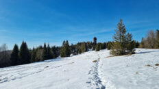
02:00:12 Jaworzyna Kamienicka Mountain
02:03:49 Jaworzyna Kamienicka Glade
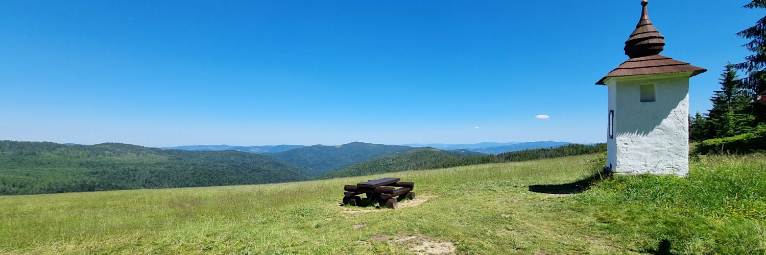
02:04:03 Bulanda Chapel
Jaworzyna Kamienicka Mountain – a peak at 1288 m a.s.l. in the Gorce Mountains, the second highest after Turbacz (1310 m a.s.l.). It is located in the Gorce Range, branching off from Turbacz and extending for several kilometers to the Gorce Mountains in the east. To the southwest, it borders Trzy Kopce (1281 m a.s.l.) and Średniak (1190 m a.s.l.) to the east. The northern slopes descend into the deep Kamienica Valley, while the southern slopes descend to the Forędówki Stream. Jaworzyna Kamienicka is located within the Gorce National Park.
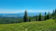
The summit of Jaworzyna Kamienicka is undistinguished, barely distinguishable from the flat plateau. It is covered by an upper montane spruce forest, and due to the flat terrain, wetlands occur in many places. On the northeastern slopes lies the vast Jaworzyna Kamienicka Glade. The glade offers beautiful views of the nearby Kudłoń, Gorc Troszacki, and Gorc peaks, with the Kamienica Valley below them, and the peaks of the Wyspowy Beskid and the Sącz Beskid Mountains visible in the distance.
On the western slopes of Jaworzyna lies the approximately 15-meter-long Zbójecka Jama crevice cave.
Near the peak runs the green Grywałd – Gabrowska Glade hiking trail and the green-marked “From Turbacz to Jaworzyna Kamienicka” educational trail.
Hike recorded on July 3, 2025.