Virtual hike: Descent from Kozí chrbát to Donovaly, Slovakia
Route: Kozí chrbát (1330 m a.s.l.; 48.860116, 19.290426) – Hiadeľské sedlo (1099 m a.s.l.; 48.862288, 19.304362) – Hadlanka Pass (1130 m a.s.l.; 48.856186, 19.254812) – Kečka Mountain (1225 m a.s.l.; 48.856186, 19.254812) – Bulovský príslop (1125 m a.s.l.; 48.856508, 19.249575) – Štrosy nature reserve (1134 m a.s.l.; 48.857127, 19.248739) – Polianky (1042 m a.s.l.; 48.865849, 19.222877) – Vrchlúka (1027 m a.s.l.; 48.869521, 19.219406) – Donovaly (987 m a.s.l.; 48.878183, 19.224121)
Trail designation: red trail, yellow trail
Length: about 10.7 km
Walking time: about 3:30 h
Sum of approaches: 197 m
Sum down: 541 m
00:00:20 Kozí chrbát
00:37:30 Hiadeľské sedlo
00:39:46 Crossing of trails
00:42:49 Kozí chrbát nature reserve
00:51:45 Spring
01:21:59 Crossing of trails
01:29:57 Hadlanka Pass
01:45:30 Handliarka
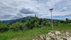
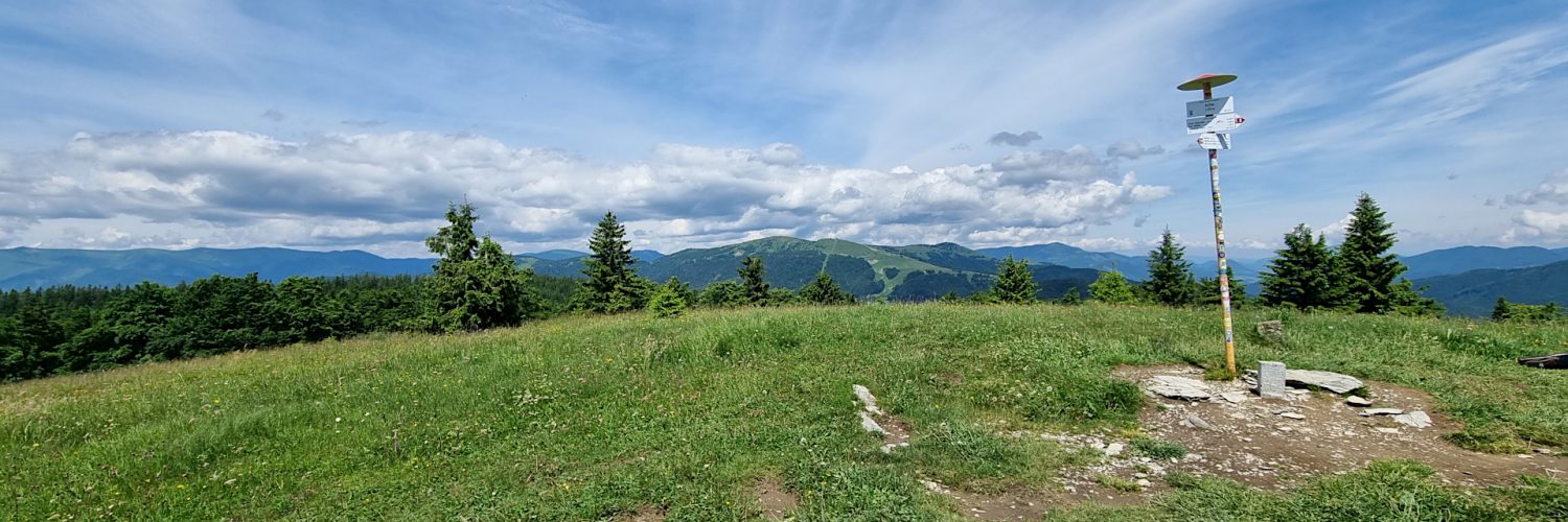
01:56:07 Kečka Mountain
02:15:38 Bulovský príslop
02:17:22 Štrosy nature reserve
02:20:20 Stone run
03:00:31 Chapel
03:01:31 Polianky
03:06:37 Chapel
03:23:00 Donovaly
Kečka Mountain – a peak 1225 m a.s.l. in the main ridge of the Staré Hory in Slovakia. It is the second highest peak of this mountain range. It is located between the peaks of Barania hlava (1206 m) from the west and Hadliarka (1211 m) from the east. To the north, a short ridge with the peak of Kochuľa descends from Kečka, forming the western slopes of the Veľká Šindliarka valley, the south-eastern slopes descend to the Uhliarska Valley.
The peak of Kečka is domed and grassy, covered with shepherd’s pastures. The entire ridge stretching from Kečka to Kozí chrbát is grassy. Thanks to the grassy meadows, the ridge offers a wide panorama of views including the peaks of the Low Tatras, the Slovak Rudohorie, the Kremnica Mountains, the nearby Veľká Fatra and Veľký Choč.
A watershed runs through the ridge, water from the northern slopes flows through the tributaries of the Korytnice to the Revúca and Váh, while the southern slopes are the source of the Uhliarske stream in the Hrona basin.
Kečka is located in the area of the Low Tatras National Park. A red trail leads through it, which is a section of the Cesta hrdinov SNP trail. It is the longest hiking trail in Slovakia leading along the peaks and ridges of the mountains.
The hike recorded on June 14, 2024.