Virtual hike: Ascent to Kozí chrbát from Donovaly, Slovakia
Route: Donovaly, parking (976 m a.s.l.; 48.877368, 19.224712) – Vrchlúka (1027 m a.s.l.; 48.869521, 19.219406) – Polianky (1042 m a.s.l.; 48.865849, 19.222877) – Štrosy nature reserve (1172 m a.s.l.; 48.854443, 19.246210) – Bulovský príslop (1125 m a.s.l.; 48.856508, 19.249575) – Kečka Mountain (1225 m a.s.l.; 48.856186, 19.254812) – Hadlanka Pass (1130 m a.s.l.; 48.856186, 19.254812) – Kozí chrbát (1330 m a.s.l.; 48.860116, 19.290426)
Trail designation: green trail, red trail
Length: about 8.1 km
Walking time: about 3:00 h
Sum of approaches: 483 m
Sum down: 141 m
00:00:18 Donovaly, parking
00:01:25 Crossing of trails
00:22:02 Vrchlúka
00:23:59 Chapel
00:29:22 Polianky
00:30:38 Chapel
01:08:56 Štrosy nature reserve
01:12:41 Stone run
01:17:08 Bulovský príslop
01:31:37 Kečka Mountain
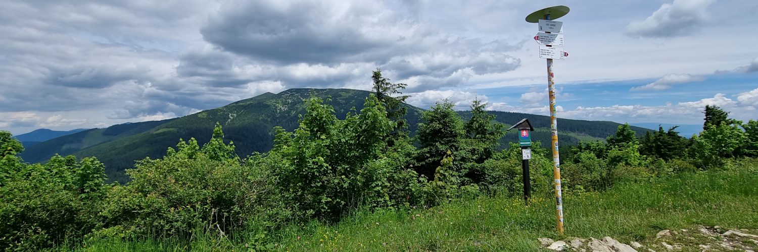
01:52:18 Handliarka
02:03:38 Hadlanka Pass
02:11:40 Crossing of trails
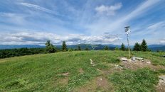
02:37:07 Kozí chrbát
Kozí chrbát Mountain – a peak with a height of 1330 m a.s.l. in the Staré Hory Mountains in Slovakia. It is the highest peak of this mountain range. It is located at their eastern end just above the Hiadeľské sedlo pass separating it from the Low Tatras.
The eastern slopes of Kozí chrbát descend steeply to the Hiadeľské sedlo pass (1099 m) and to two valleys descending from it in opposite directions: Barboriná Valley and Hiadeľská Valley. The relative height of the peak above this pass is 231 m. The western slopes descend to the Hadlanka pass (approx. 1150 m), the relative height difference here is about 180 m. The southern slopes descend to the Uhliarska Valley.
The peak of Kozí chrbát is covered with former shepherds’ meadows, thanks to which a wide panorama of views stretches from it, including the peaks of the Low Tatras, the Slovak Ore Mountains, the Kremnica Mountains, the nearby Veľká Fatra and Veľký Choč. The grassy ridge stretches from Kozí chrbát to the western slopes of Kečka. The peaks of Kozí chrbát are made of limestone rocks covering crystalline rocks. Thanks to this, it is characterized by rich vegetation. On the northern slopes descending to the Barboriná Valley, the Kozí chrbát nature reserve was established.
Kozí chrbát is easily accessible from the ski resort in Donovaly and from Korytnice-kúpele. From Donovaly, there is a much smaller difference in altitude to the approach. The red trail, which is a section of the Cesta hrdinov SNP trail, leads through the peak.
The hike recorded on June 14, 2024.