Virtual hike: Descent from Velký Polom Mountain through Malý Polom to Horní Lomná, Czech Republic
Route: Velký Polom (1067 m a.s.l.; 49.506197, 18.671016) – Muřinkový vrch, chapel (952 m a.s.l.; 49.502939, 18.658175) – Muřinkový vrch (975 m a.s.l.; 49.503033, 18.654646) – Burkův vrch (1032 m a.s.l.; 49.496137, 18.639528) – Čuboňov (1014 m a.s.l.; 49.497944, 18.601631) – Malý Polom (1061 m a.s.l.; 49.509494, 18.598191) – Horní Lomná (629 m a.s.l.; 49.517809, 18.630858)
Trail designation: red trail, blue trail, paths marked on the map
Length: about 12.3 km
Walking time: about 4:00 h
Sum of approaches: 298 m
Sum down: 743 m
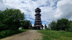
00:00:22 Velký Polom
00:12:42 Rocks
00:14:54 Rock
00:26:16 Muřinkový vrch, chapel
00:26:59 Chapel
00:27:32 Studánka Na Muřinkovém Vrchu
00:31:08 Going off the trail
00:34:31 Muřinkový vrch
00:39:12 Return to the red trail
00:56:09 Going off the trail
01:01:22 Burkův vrch
01:08:56 Return to the red trail
01:19:16 Spring
01:40:20 Going off the trail
01:42:04 Blue trail
01:48:41 Going off the trail
01:55:56 Čuboňov
02:10:37 Unnamed pass
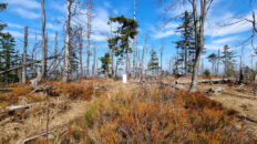
02:27:09 Malý Polom
02:44:33 Red trail
02:46:06 Lučka Stream
02:52:52 Mechový Spring
03:02:52 Crossing of trails
03:06:42 Crossing of trails
03:25:01 Kyčmol Stream
03:34:26 Kyčmol Stream
03:45:13 Kyčmol Stream
03:49:56 Horní Lomná
Malý Polom – a peak at 1061 meters above sea level in the eastern part of the Moravian-Silesian Beskids. It serves as a keystone for several branching ridges. To the north, a ridge branches off towards the Ropice Ridge, to the northwest, a ridge branches off towards Mituří Peak, to the west, a ridge with Polomka Peak, and to the south, a ridge with Čuboňov Peak, which then branches off into two ridges: a short one to the southwest with Uhorská Peak and an eastern peak, Veľký Polom. The southwestern slopes descend steeply into the Predmieranka Stream Valley, where the Malý Polom Nature Reserve has been established. The eastern slopes also descend steeply into the Kyčmol Stream Valley, and the northern slopes descend to the Skalka Stream.
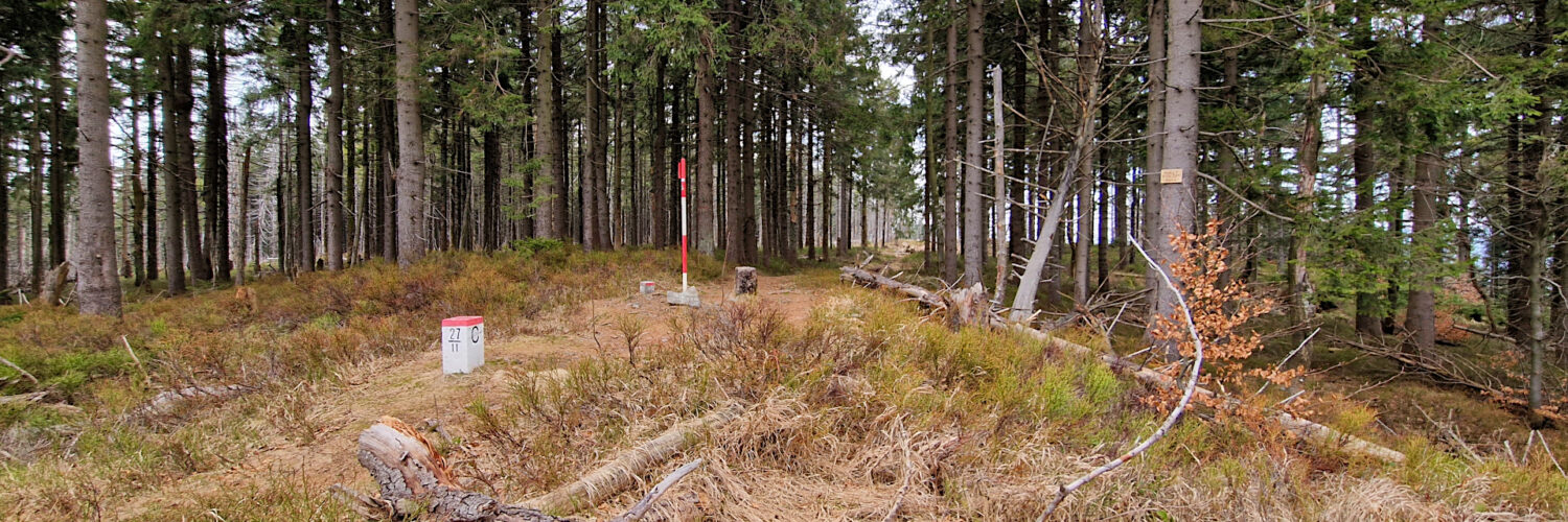
The Czech-Slovak border runs through the peak. The ridge runs along the watershed between the Black Sea and the Baltic Sea.
Malý Polom is covered by a lower montane mixed forest, dominated by spruce and mixed with beech and fir. In the peaks, there are fragments of upper montane spruce forest. Currently, the spruce trees are attacked by the bark beetle, causing them to die en masse.
The summit is reached by a marked path along the Czech-Slovak border. The red hiking trail traverses the summit from the east and north.
The hike recorded on March 28, 2025.