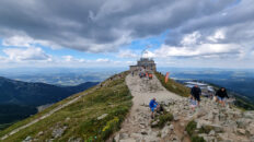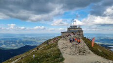
Virtual hike: Descent from Starorobociański Wierch through Siwy Zwornik Mountain to Chochołowska Valley, Poland
Route: Starorobociański Wierch (2176 m a.s.l.; 49.199366, 19.819931) – Gaborowa Pass (1940 m a.s.l.; 49.201341, 19.826666) – Siwy Zwornik Mountain (1964 m a.s.l.; 49.201693, 19.829421) – Siwa Pass (1913 m a.s.l.; 49.205011, 19.833387) – Chochołowska Valley (1052 m a.s.l.; 49.244279, 19.811662)
Trail designation: red trail, green trail, black trail
Length: about 6.6 km
Walking time: about 3:00 h
Sum of approaches: 20 m
Sum down: 1152 m
00:00:18 Starorobociański Wierch
00:34:00 Gaborowa Pass
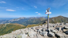
00:38:13 Siwy Zwornik Mountain
00:42:15 Crossing of trails
00:44:47 Siwe Stawki
00:50:11 Siwe Turnie
00:56:49 Siwe Stawki
01:00:02 Siwa Pass
01:19:31 Żleb pod Pyszną Stream
01:25:51 Żleb pod Pyszną Stream
01:33:13 Starorobociańska Valley
01:44:47 Żleb na Przełęcz Stream
01:46:11 Landslide in Trzydniowiański Wierch
02:16:47 Starorobociański Stream
02:20:43 Starorobociański Stream
02:33:26 Crossing of trails
02:43:16 Chochołowska Valley
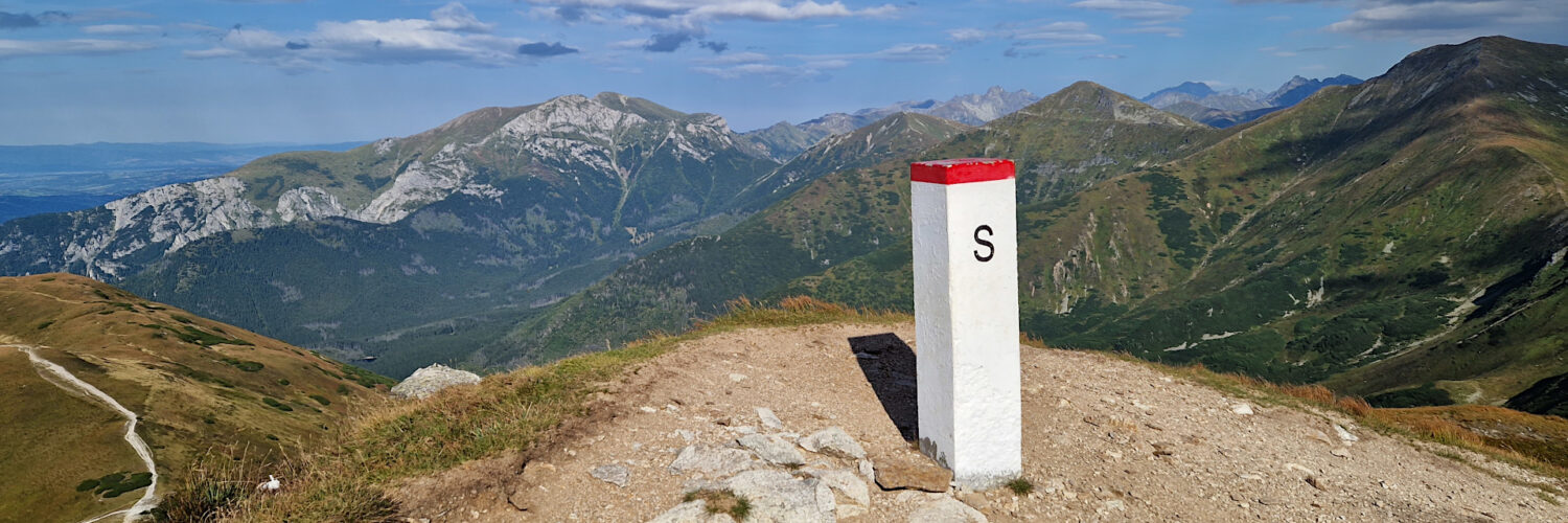
Siwy Zwornik Mountain – a peak with a height of 1964 m a.s.l. in the Western Tatra Mountains. It is located in the main ridge of the Tatras on the Polish-Slovak border. From the west, through Gaborowa Pass, it borders Starorobociański Wierch, from the north, through Siwa Pass, it borders Kotłowa Czuba, and from the south-east, through Banista Pass, it borders the Błyszcz peak. To the north, the Ornak ridge descends to the Iwaniacka Pass. The northwestern slopes descend to the Starorobociański Valley, the northeastern slopes descend to the Pyszniańska Valley, and the southern slopes descend to the Gaborova Valley in Slovakia.
Siwy Zwornik is composed of metamorphic rocks and igneous granitoids. On its northern and western sides, its slopes are rocky and quite steeply undercut. The remaining slopes are covered with low grasslands with the common rush, which turns red in autumn.
From the summit, there is a distant view of the Western Tatras Mountains, the High Tatra Mountains, the Low Tatra Mountains, the Żywiec-Orawa Beskid Mountains, and the Gorce Mountains. The Starorobociańska Valley is perfectly visible along its entire length.
At the summit, the red Pyszniańska Przełęcz – Wołowiec hiking trail intersects with the green Iwaniacka Przełęcz – Siwy Zwornik hiking trail on the Polish side, and the green Pod Klinom – Siwy Zwornik hiking trail on the Slovak side.
Hike recorded on August 28, 2025.