Virtual hike: Ascent to Wielka Cisowa Grapa from Międzybrodzie Żywieckie, Poland
Route: Międzybrodzie Żywieckie, cemetery (341 m a.s.l.; 49.764831, 19.214297) – Głęboki Stream (386 m a.s.l.; 49.764831, 19.214297) – Czarnoci Forest (604 m a.s.l.; 49.752641, 19.226461) – Crossroads at Kościelec (741 m a.s.l.; 49.752507, 19.233936) – Kościelec Mountain (796 m a.s.l.; 49.754800, 19.235506) – Jaworzyna Mountain (861 m a.s.l.; 49.759249, 19.243426) – Cisowa Pass (797 m a.s.l.; 49.771989, 19.256483) – Maleckie Mountain (845 m a.s.l.; 49.775109, 19.256760) – Wielka Cisowa Grapa Mountain (853 m a.s.l.; 49.778144, 19.261919)
Trail designation: green trail, blue trail, paths marked on the map
Length: about 7.0 km
Walking time: about 2:45 h
Sum of approaches: 567 m
Sum down: 60 m
00:00:31 Międzybrodzie Żywieckie, cemetery
00:06:39 Głęboki Stream
00:35:12 Czarnoci Forest
00:50:25 Spring
00:51:00 Crossroads at Kościelec
00:57:02 Kościelec Mountain
01:12:01 Jaworzyna Mountain
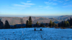
01:40:39 Cisowa Pass
01:41:25 Szeroka Nature Reserve in the Mały Beskid Mountains
01:44:39 Going off the trail
01:49:02 Going off the road
01:51:44 Maleckie Mountain
01:55:06 Return to the road marked on the map
01:55:39 Going off the road
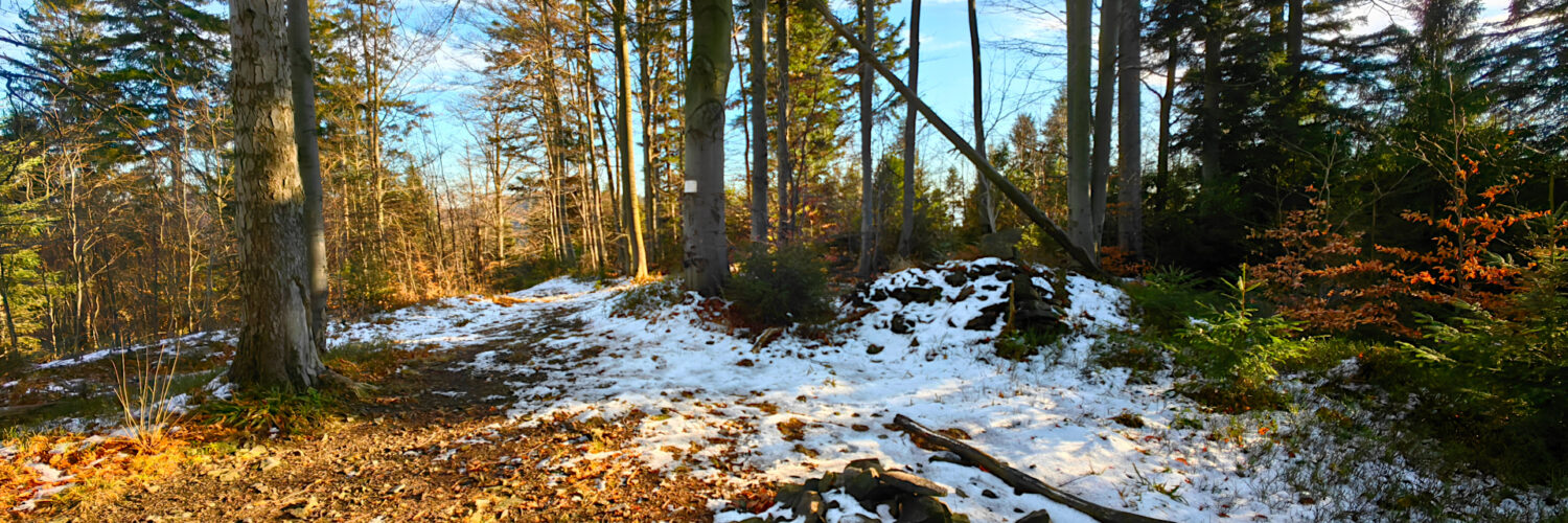
01:59:25 A viewpoint already overgrown with forest
02:02:56 Return to the road marked on the map
02:09:28 Wielka Cisowa Grapa Mountain
Wielka Cisowa Grapa – a peak at an altitude of 853 m a.s.l. in the Mały Beskid Mountains. According to the State Register of Geographical Names, the official name of the peak is Cisowe Grapy. It is located in the eastern part of the Mały Beskid Mountains, informally called the Andrychów Beskid. It is a keystone for three ridges. To the southwest, a ridge branches off through Maleckie Mountain, Jaworzyna Mountain and Stary Groń Mountain, descending to Żywiec Lake. To the northwest, through Wielki Cisownik Mountain, Isepnicka Pass, Kiczora Mountain and Żar Mountain, a ridge branches off, descending to Międzybrodzie Lake. To the east, the main ridge of the Mały Beskid Mountains branches off, running through Wielka Góra (Kocierz) and the Beskid Mountain to Kocierz Pass.
Hike recorded on December 2, 2024.