

Virtual hike: A walk through the Wolski Forest in Kraków, Poland
Route: Parking on Łysa Góra, Kraków (271 m a.s.l.; 50.059618, 19.862833) – Wolski Dół, entrance to the gorge (241 m a.s.l.; 50.062969, 19.861386) – Panieńskie Skały (272 m a.s.l.; 50.061202, 19.858740) – Wolski Dół, exit from the gorge (341 m a.s.l.; 50.054430, 19.847503) – Janasówki Pass (324 m a.s.l.; 50.057173, 19.847488) – Sowiniec Hill (354 m a.s.l.; 50.060597, 19.845447) – Józef Piłsudski Mound (384 m a.s.l.; 50.060046, 19.847167) – Janasówki Pass (324 m a.s.l.; 50.057173, 19.847488) – Ostra Góra (348 m a.s.l.; 50.053312, 19.843642) – Łupany Dół, entrance to the gorge (325 m a.s.l.; 50.051952, 19.845155) – Łupany Dół, crossing of trails (292 m a.s.l.; 50.048647, 19.841829) – Viewpoint (245 m a.s.l.; 50.045183, 19.848754) – Bridge over Skowronków Dół (255 m a.s.l.; 50.048583, 19.858215) – Viewpoint (289 m a.s.l.; 50.055758, 19.865014) – Poniedziałkowy Dół (249 m a.s.l.; 50.058124, 19.865899) – Baba Jaga (270 m a.s.l.; 50.058840, 19.862018) – Parking on Łysa Góra, Kraków (271 m a.s.l.; 50.059618, 19.862833)
Trail designation: red trail, green trail, black trail, yellow trail, blue trail
Length: about 10.5 km
Walking time: about 3:30 h
Sum of approaches: 338 m
Sum down: 338 m
00:00:19 Parking on Łysa Góra, Kraków
00:03:00 Panieńskie Skały Reserve
00:06:01 Wolski Dół, entrance to the gorge
00:12:10 Panieńskie Skały
00:35:53 Wolski Dół, exit from the gorge
00:40:43 Janasówki Pass
00:44:59 Crossing of trails
00:46:33 Going off the trail
00:48:15 Sowiniec Hill
00:57:45 Józef Piłsudski Mound
01:13:12 Janasówki Pass
01:21:17 Going off the trail
01:23:15 Krakow Fortress Ammunition Bunker
01:25:12 Chapel
01:25:50 Ostra Góra
01:28:57 Crossing of trails
01:30:48 Łupany Dół, entrance to the gorge
01:37:43 Łupany Dół, crossing of trails
01:40:02 Crossing of trails
01:49:30 Viewpoint
02:07:00 Bridge over Skowronków Dół
02:15:28 Crossing of trails
02:23:36 Crossing of trails
02:26:09 Wroni Dół
02:28:12 Viewpoint
02:30:20 Going off the trail
02:35:32 Poniedziałkowy Dół
02:42:15 Baba Jaga
02:44:30 Parking on Łysa Góra, Kraków
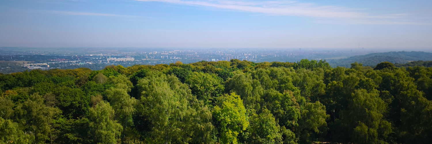
Wolski Forest – a forest area located on the hills of the Krakow Bridge, on the left bank of the Vistula River. Administratively, the forest is located in the western part of Krakow, in the Wola Justowska district. It covers an area of 420 hectares and forms part of the Krakow Municipal Forests.
Wolski Forest covers the hills of the Sowiniec Range: Sowiniec (354 m above sea level), Pustelnik (353 m above sea level), Ostra Góra (348 m above sea level), and Srebrna Góra (322 m above sea level). Numerous limestone outcrops can be found here. The largest of these are Panieńskie Skały, Bielańskie Skałki, Wolski Murek, and Kawalerskie Skały. The rocks of the Zielony Dół ravine contain the Wolski Forest Cave, the Zielony Dół Cave, and the Zielony Dół Shelter. In Kawalerskie Skały, there is a crevice in front of the Gamekeeper’s House, and in the small rocks west of Kawalerskie Skały, there is a crevice under the Gamekeeper’s House. On Srebrna Góra, there is the Bielany Cavern and a shelter near the village of Bielany.
The hills of the Wolski Forest are cut by numerous ravines and gorges. The largest of these are: Wolski Dół, Skowronków Dół, Łupany Dół, Poniedziałkowy Dół, Wroni Dół, Wilczy Dół, Zielony Dół, Mokry Dół, and Gomółczy Dół.
The species composition of the forest stands is close to natural, with deciduous trees predominating, primarily beeches, oaks, and birches, with some fir, hornbeam, linden, maples, and sycamores. The forests consist of birch-oak, birch-oak-beech, mixed oak, solid beech, mixed beech, and mixed birch. Several natural monuments can be found here: common beech in the Juliusz Lea clearing and Douglas firs in Zakamycz. Protected plants such as daphne and lily of the valley can be found in the undergrowth. The forest also includes several clearings: the Juliusz Lea clearing, the Sowiniec clearing, the Wincenty Wobr clearing, the Jacek Malczewski clearing, the Bielańska clearing, the Scout clearing, the Pod Klasztorem clearing, and the Wesoła clearing.
Three nature reserves have been established in the Wolski Forest. The Bielańskie Skałki nature reserve is a strict, floristic reserve covering an area of 1.73 hectares, established in 1957 to protect xerothermic grasslands. The Panieńskie Skały Reserve – a 6.41-hectare forest and landscape reserve, established in 1953 to protect the only fragment of natural forest near Krakow with picturesque limestone rocks. The Skałki Przegorzalskie Reserve – a 1.38-hectare strict floristic reserve, established in 1959 to protect rare rocky and xerothermic grasslands and thermophilic shrubs. The forest features walking and hiking trails: the red-marked North-South Chełm-Bielany Trail, the green-marked Two Mounds Salwator-Kryspinów Trail, the yellow-marked Wolski Forest Gorges Trail Wola Justowska-Polana pod Dębiną, the yellow-marked Belwederski Przegorzały Trail-Zoological Garden, the blue-marked Piłsudski Mound Circular Trail-Zoological Garden, the black-marked Sikornik Trail Wola Justowska-Kozie Nogi, the black-marked East-West Trail Wola Justowska-Zakamycze, and the black-marked Split Hole Trail Polana pod Dębiną-Bielany. A section of the northern loop of the Kraków Fortress Trail also runs through the Wolski Forest.
The most important tourist attractions are the Hermitage and the Camaldolese Church on Srebrna Góra, the Zoo, the Baszta Villa in Przegorzały, the Castle in Przegorzały, the Józef Piłsudski Mound, and the Okocim Pavilion.
Hike recorded on September 10, 2025.