Virtual hike: Ascent to Kasprowy Wierch from Kuźnice, Poland
Route: Kuźnice, Bystra Stream (1022 m a.s.l.; 49.268995, 19.981473) – Przełęcz między Kopami (1502 m a.s.l.; 49.254924, 20.003222) – PTTK Murowaniec Shelter (1500 m a.s.l.; 49.243273, 20.006932) – Sucha Pass (1950 m a.s.l.; 49.230990, 19.983038) – Kasprowy Wierch (1987 m a.s.l.; 49.231797, 19.981561)
Trail designation: yellow trail, blue trail,
Length: about 7.4 km
Walking time: about 3:30 h
Sum of approaches: 1019 m
Sum down: 51 m
00:00:22 Kuźnice, Bystra Stream
00:01:41 Jaworzynka Valley
00:03:41 Jaworzynka Stream
00:07:35 Jaworzynka Glade
01:02:08 Przełęcz między Kopami
01:21:30 Hala Gąsienicowa
01:25:15 Gąsienicowa Valley
01:26:17 Crossing of trails
01:30:05 PTTK Murowaniec Shelter
01:32:38 Crossing of trails
01:36:40 Mokra Jama Lake
01:39:53 Crossing of trails
01:51:23 Dwoiśniak
01:53:36 Crossing of trails
02:02:28 Crossing of trails
02:02:43 Stream
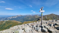
02:35:02 Sucha Pass
02:35:17 Crossing of trails
02:39:45 Cable car station
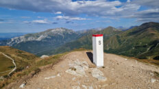
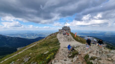
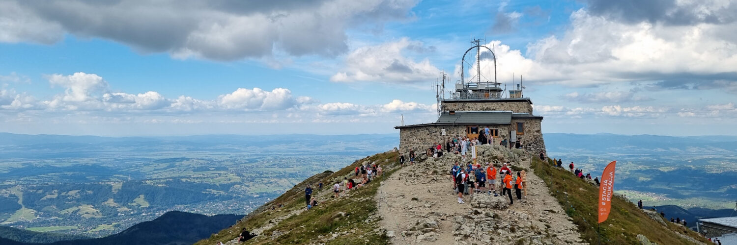
02:45:09 Kasprowy Wierch
Kasprowy Wierch – a peak at an altitude of 1987 m a.s.l. in the Western Tatras. It is located in the main ridge of the Tatras on the Polish-Slovak border. To the west, it borders the Pośredni Wierch Goryczkowy peak through the Przełęcz nad Zakosy Pass, and to the east, it borders the Beskid peak through the Sucha Pass. To the north, a ridge branches off, descending through Sucha Czuba and Myślenickie Turnie to the Bystra Valley. To the northeast, a long ridge branches off, descending through Uhrocie Kasprowe, Kopa Magura, and Królowy Grzbiet to the Suchej Woda Valley. The southern slopes descend to the Cicha Valley in Slovakia, the northwestern slopes descend to the Pod Zakosy Valley, a branch of the Goryczkowa Valley, the northern slopes descend to the Sucha Kasprowa Valley, and the northeastern slopes descend to the Gąsienicowa Valley. The summit of Kasprowy Wierch is composed of crystalline rocks (granodiorites and pegmatites), despite its location in the younger part of the Tatra Mountains, which is composed of sedimentary rocks. It belongs to the so-called Goryczkowa crystal island. The peak is rocky and offers views of the Western Tatras, the High Tatras, the Low Tatras, the Gorce Mountains, the Sądecki Beskids, and the Żywiec-Orawski Beskids.
Below the summit is the High-Alpine Meteorological Observatory on Kasprowy Wierch, and slightly lower is the Kasprowy Wierch Cable Car station, complete with a building and tourist infrastructure. Kasprowy Wierch is home to Poland’s highest-altitude ski resort. The resort boasts the Kasprowy Wierch Cable Car, the Hala Gąsienicowa Chairlift, and the Hala Goryczkowa Chairlift. Two main ski trails lead from the summit: the Goryczkowa Trail and the Gąsienicowa Trail.
The red-marked Zawrat – Kościeliska Valley tourist trail leads to Kasprowy Wierch, the green-marked Kuźnice – Kasprowy Wierch tourist trail and the yellow-marked Schronisko Murowaniec – Kasprowy Wierch tourist trail.
Hike recorded on August 20, 2025.