Virtual hike: Descent from Ďumbier Mountain through Chopok Mountain to Srdiečko, Slovakia
Route: Ďumbier Mountain (2045 m a.s.l.; 48.936399, 19.640266) – Krúpovo Sedlo Pass (1905 m a.s.l.; 48.938779, 19.630981) – Demänovské Sedlo Pass (1756 m a.s.l.; 48.939995, 19.619438) – Chopok Mountain (2024 m a.s.l.; 48.943009, 19.592716) – Medzistanice (1500 m a.s.l.; 48.932724, 19.597951) – Srdiečko (1216 m a.s.l.; 48.924067, 19.602686)
Trail designation: red trail, yellow trail
Length: about 8.2 km
Walking time: about 3:50 h
Sum of approaches: 249 m
Sum down: 1067 m
00:00:18 Ďumbier Mountain
00:28:40 Krúpovo Sedlo Pass
00:46:45 Crossing of trails
00:50:46 Demänovské Sedlo Pass
01:39:32 Kamenná chata pod Chopkom
01:40:09 Crossing of trails
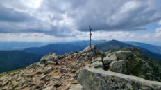
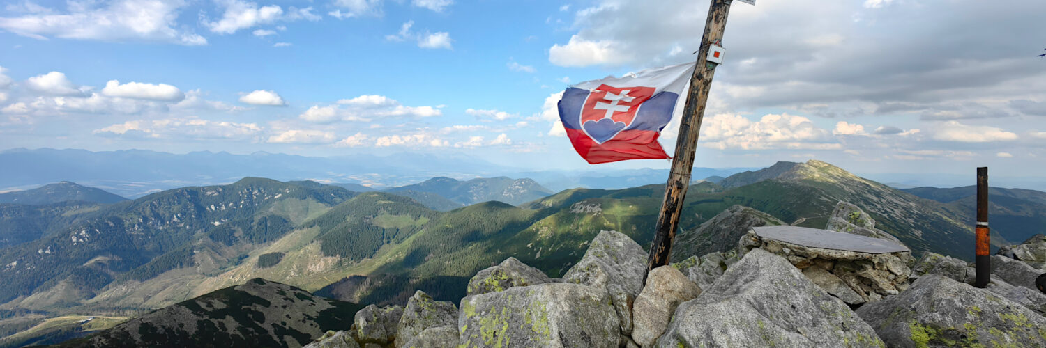
01:46:04 Chopok Mountain
02:45:20 Going of the trail
02:51:40 Crossing of trails
02:55:04 Múzeum Lanovky
03:23:32 Srdiečko
Chopok – a peak at an altitude of 2024 m a.s.l. in the Low Tatras in Slovakia. It is located in the main ridge of the Low Tatras, in the highest part of their western part, known as the Ďumbierské Tatry. To the west, it borders the Dereše peak (2004 m a.s.l.) and to the east, the Konské peak (1874 m a.s.l.). To the north, into the Demänovská Valley, a rocky and grassy ridge descends from it, dividing to the right the Konský grúň peak, forming the western slopes of the Luková Valley cirque. To the south, the slopes drop quite steeply to the Bystrá Valley.
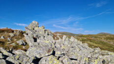
Chopok is a distinctive peak with a dome-shaped summit, “piled up” from large rock blocks. It is composed of “Dziumbiersky” granite, so its relief is similar to that of the neighboring peaks: Konské (1875 m a.s.l.) and Dereše (2004 m a.s.l.).
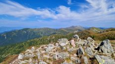
The summit offers distant views of the Tatra Mountains, the Choč Mountains, the Oravská Magura, the Żywiec-Orava Beskids, the Little Fatra, the Poľana, the Veporské vrchy, the Stolické vrchy, Vtáčnik, and the Muránska planina.
A three-stage cable car runs from Demänovská Valley to the summit of Chopok. Its upper station is located on the main ridge, just on the western side of the peak. Just below the summit dome, the Kamienna Chata mountain hut is located at an altitude of 2,000 m. At the foot of Chopok lies the large Jasná ski resort. It is divided into two parts: northern and southern. It is the largest ski resort in Slovakia. The ski trails, with a total length of 45 km, are served by three gondola lifts, one funicular, nine chairlifts, and 16 ski lifts with a total capacity of 32,000 people per hour.
The red Cesta hrdinov SNP hiking trail, the blue Iľanovo – Chopok hiking trail, and the yellow Trangoška – Chopok hiking trail intersect below the peak.
Hike recorded on July 21, 2025