Virtual hike: Ascent to Ďumbier Mountain from Trangoška, Slovakia
Route: Trangoška (1121 m a.s.l.; 48.925160, 19.610613) – Ďumbierske Sedlo Pass (1728 m a.s.l.; 48.926606, 19.650387) – Krúpovo Sedlo Pass (1905 m a.s.l.; 48.938779, 19.630981) – Ďumbier Mountain (2045 m a.s.l.; 48.936399, 19.640266)
Trail designation: green trail, red trail
Length: about 6.3 km
Walking time: about 3:00 h
Sum of approaches: 967 m
Sum down: 49 m
00:00:19 Trangoška
00:02:18 Chata Zázvor
00:06:38 Bystrianka River
00:07:12 Bystrianka River
00:10:34 Bystrianka River
00:12:51 Bystrianka River
00:39:21 Detour to the cave of dead bats
00:43:25 Stream
00:46:29 Avalanche Memorial 1935
01:18:29 Chata generála Milana Rastislava Štefánika
01:19:52 Ďumbierske Sedlo Pass
01:20:05 Crossing of trails
01:28:11 Spring
01:36:19 Marmot
01:45:11 Crossing of trails
02:11:07 Crossing of trails
02:18:33 Krúpovo Sedlo Pass
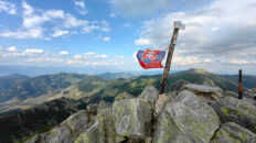
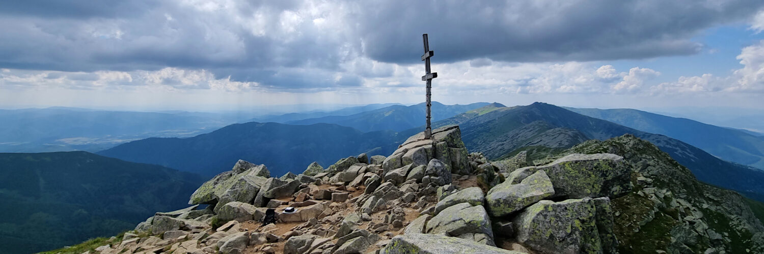
02:38:43 Ďumbier Mountain
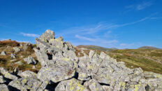
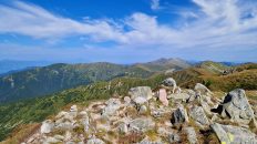
Ďumbier – a peak at 2045 m a.s.l. in the Low Tatras in Slovakia. It is the highest peak in this mountain range. It is located in the main ridge of the Low Tatras, bordered on the east by Štiavnica Peak (2025 m a.s.l.) and on the west by Krúpovo Sedlo Pass, Krúpova Hoľa Peak (1922 m a.s.l.). On the southern side, slopes covered with fields of granite boulders gently descend to the upper part of Bystrá Valley, while the northern slopes descend with steep walls and pillars to two glacial cirques in the highest part of the Jánska Valley. These walls are almost 500 m high. The cirques are separated by a short ridge called Ludárova Hoľa, descending from Ďumbier. At the bottom of the western cirque lies the small lake, Bystré pleso.
The summit sections of the mountain, as well as the sections of the main Tatra Lowlands ridge running in both directions, are composed of deep-sea crystalline rocks, primarily biotite tonalites and granodiorites. Lower down the southern slopes, a horizontal belt of banded and striated gneisses and migmatites from the earlier Paleozoic stretches, and below it, a belt of limestones and dolomites from the Middle and Younger Triassic, in which the large Dead Bats Cave developed.
The summit is rocky, offering views of the Tatra Mountains, the Choč Mountains, the Oravská Magura, the Żywiec-Orava Beskids, the Little Fatra Mountains, the Poľana Mountains, the Veporské vrchy, the Stolické vrchy, Vtáčnik, and the Muránska planina.
A red-marked hiking trail leads to the summit from the Krúpovo sedlo pass.
Hike recorded on July 21, 2025