Virtual hike: Ascent to Kiczorka Mountain from Krowiarki Pass, Poland
Route: Krowiarki Pass (1011 m a.s.l.; 49.588177, 19.582840) – Sychlec Mountain (1151 m a.s.l.; 49.592836, 19.592074) – Głowniak Mountain (1093 m a.s.l.; 49.598049, 19.593718) – Brożki Glade (1176 m a.s.l.; 49.612575, 19.583197) – Brożki Mountain (1235 m a.s.l.; 49.613070, 19.587051) – Pólko Mountain (1249 m a.s.l.; 49.616531, 19.588447) – Kiczorka Mountain (1298 m a.s.l.; 49.622603, 19.590361) – Bocianie Gniazdo Rock (1295 m a.s.l.; 49.622628, 19.589696)
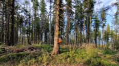
Trail designation: red trail
Length: about 5.4 km
Walking time: about 2:00 h
Sum of approaches: 953 m
Sum down: 0 m
00:00:17 Krowiarki Pass
00:17:51 Sychlec Mountain
00:29:02 Going off the trail
00:30:25 Głowniak Mountain
00:32:59 Return to the red trail
00:51:40 Going off the trail
01:03:00 Brożki Glade
01:14:44 Brożki Mountain
01:23:21 Red trail
01:27:01 Pólko Mountain
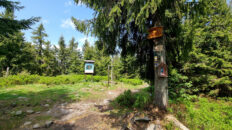
01:37:51 Kiczorka Mountain
01:39:27 Bocianie Gniazdo Rock
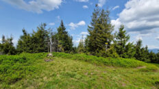
Kiczorka Mountain (Cyl Hali Śmietanowej) – a peak with an elevation of 1298 m a.s.l. in the Żywiec-Orawa Beskid Mountains. It is located in the western part of the Polica Range. To the east, it borders Polica, to the west, Mosorna (Mosorny Groń) peak, and to the south, Pólko peak. The northern slopes descend to the Skawica Górna Stream and are drained by the Czarnotowy Stream.
Kiczorka is the keystone of two ridges: the northern one towards Kiczorka (1012 m) and the western one towards Mosorna (Mosorny Groń) peak. Furthermore, the main ridge changes its course from latitudinal to meridional at the summit, turning south.
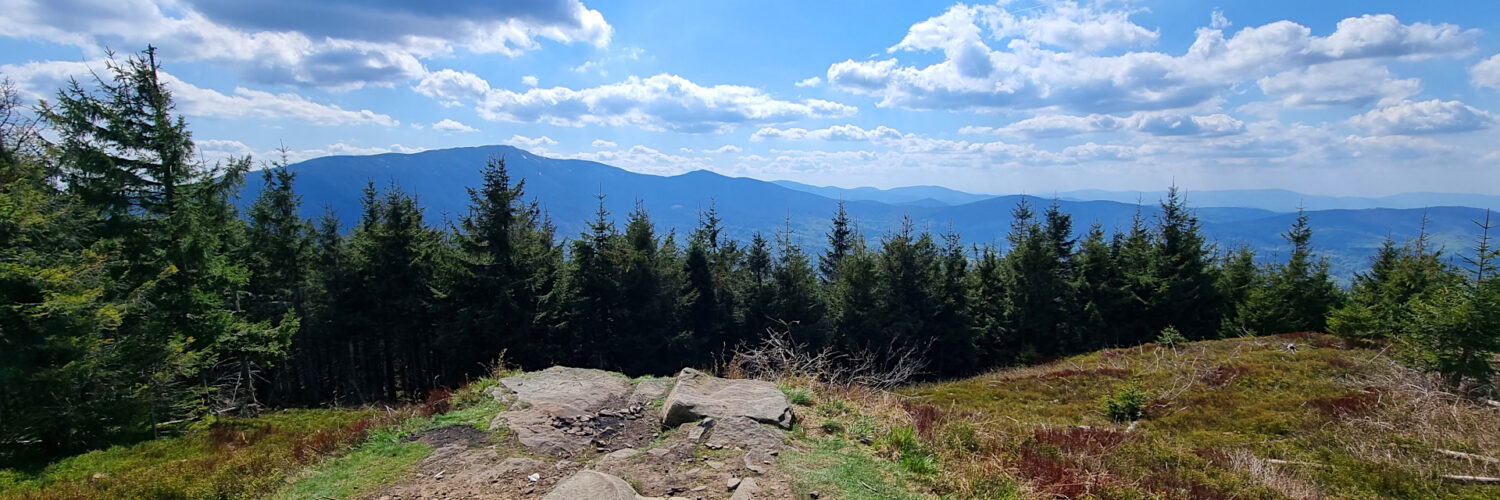
The summit is covered with upper montane spruce forest, with occasional clumps of dwarf pine. On the western side of the peak stretches the former Hala Śmietanowa, now overgrown with forest. At its upper end lies the Stork’s Nest rock formation. It offers views of Babia Góra and the surrounding peaks of the Żywiec-Orawski Beskids and the Silesian Beskids.
The peak’s former name, Cyl Hali Śmietanowej, comes from the vast Hala Śmietaniowa meadow, which was located on the western slopes of Kiczorka. The meadow was grazed until the 1960s, when sheep grazing ceased due to economic unprofitability. Currently, the meadow is overgrown with forest, with fragments remaining in the summit areas of Kiczorka and on the flattened area below the ridge running towards Mosorna.
The red-marked Main Beskid Trail runs through the summit, and the yellow-marked Zawoja-Kiczorka hiking trail begins at the summit.
Hike recorded on May 1, 2025.