Virtual hike: Ascend to Magurki Mountain from Ochotnica Górna-Jaszcze, Poland
Route: Ochotnica Górna-Jaszcze (705 m a.s.l.; 49.778144, 19.261919) – Zagroniówka, viewpoint (912 m a.s.l.; 49.526544, 20.210295) – Magurki Glade (1082 m a.s.l.; 49.529167, 20.190285) – Magurki, lookout tower (1104 m a.s.l.; 49.529167, 20.190285) – Magurki Mountain (1108 m a.s.l.; 49.530971, 20.181547) – Tomaśkula Glade (1090 m a.s.l.; 49.532562, 20.179734) – Pańska Przehybka Pass (1006 m a.s.l.; 49.537847, 20.174026) – Pańska Przehybka Glade (1014 m a.s.l.; 49.538355, 20.173302) – Monument to the Liberator bomber (1039 m a.s.l.; 49.540211, 20.174106) – Łonna Glade (870 m a.s.l.; 49.538696, 20.187630) – Ochotnica Górna-Jaszcze (705 m a.s.l.; 49.778144, 19.261919)
Trail designation: green educational trail
Length: about 9.1 km
Walking time: about 3:30 h
Sum of approaches: 442 m
Sum down: 441 m
00:00:17 Ochotnica Górna-Jaszcze
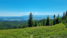
00:29:18 Zagroniówka, viewpoint
00:31:52 Shepherd’s hut
00:50:56 Crossing of trails
01:03:52 Magurki Glade
01:10:11 Shepherd’s hut
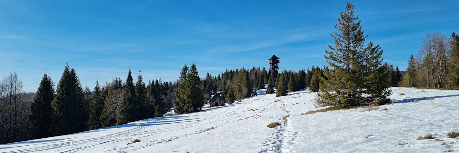
01:14:50 Magurki, lookout tower
01:23:37 Magurki Mountain
01:27:16 Tomaśkula Glade
01:36:02 Pańska Przehybka Pass
01:40:32 Pańska Przehybka Glade
01:45:33 Jaszcze Stream
01:46:23 Monument to the Liberator bomber
01:53:59 Jaszcze Stream
02:11:32 Łonna Glade
02:22:12 Jaszcze Stream
02:55:29 Ochotnica Górna-Jaszcze
Magurki Mountain – a peak at an altitude of 1108 m a.s.l. in the Gorce Mountains. It is located in a side ridge extending from Jaworzyna Kamienicka Mountain towards the south-east. It borders Jaworzyna Kamienicka via Pańska Przehybka Pass, and from the south-east it borders the Borsuczyny peak (1097 m a.s.l.). The northern slopes descend to the Jaszcze Stream and the southern ones to the Forędówka Stream.
Hike recorded on January 30, 2025.