Virtual hike: The Vistula River Mouth and the Mewia Łacha Reserve, Poland
Route: Mikoszewo, Cross (8 m a.s.l.; 54.333969, 18.946196) – The Mouth of the Vistula River (0 m a.s.l.; 54.358236, 18.953634) – Mikoszewo Beach (0 m a.s.l.; 54.351310, 18.969365) – Wał Przymorski Dune / Prince Albrecht Hill (33 m a.s.l.; 54.338805, 18.953727) – Mikoszewo, Brzegowa Street (4 m a.s.l.; 54.336951, 18.948742)
Trail designation: paths marked on the map
Length: about 6.8 km
Walking time: about 1:50 h
Sum of approaches: 30 m
Sum down: 23 m
00:00:24 Mikoszewo, Cross
00:05:34 Vistula River
00:19:11 Mewia Łacha Nature Reserve
00:39:02 The Mouth of the Vistula River
01:05:54 Mikoszewo Beach
01:32:26 Wał Przymorski Dune / Prince Albrecht Hill
01:38:33 Mikoszewo, Brzegowa Street
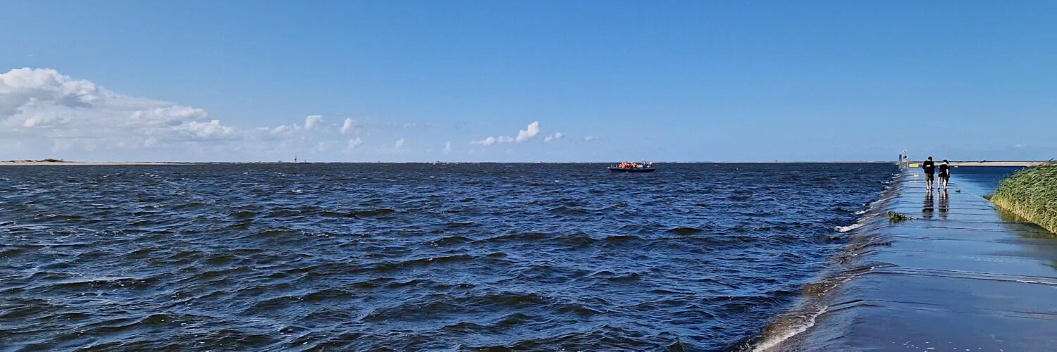
Vistula Mouth (Vistula Canal) – an artificial mouth of the Vistula River between the towns of Świbno and Mikoszewo. The 7-kilometer-long canal from Przegalina to the Bay of Gdańsk was constructed between 1891 and 1895. The former mouth of the Leniwka, from the canal to the mouth in Gdańsk, was called the Dead Vistula.
In the first half of the 19th century, in the town of Biała Góra, the Vistula split into the Nogat, which flowed into the Vistula Lagoon, and the Leniwka, which flowed into the Bay of Gdańsk. In the winter of 1840, due to flooding, the Leniwka carved a new mouth in Górki Wschodnie, which was named the Brave Vistula, while the channel through which the Leniwka previously flowed was renamed the Dead Vistula. However, the newly formed channel of the Brave Vistula was unable to accommodate the enormous volume of water. A particularly catastrophic flood in 1888 prompted the Prussian authorities to decide to connect the Vistula River directly with the Bay of Gdańsk. The canal was intended to reduce the risk of ice jam flooding by allowing ice and rising floodwaters to flow freely into the Baltic Sea.
In 1985, a modern water canal was opened, 7.1 kilometers long and 250 to 400 meters wide, surrounded by 10-meter-high flood embankments. Simultaneously with the construction of the canal, the channels of the Martwa Wisła, Szkarpawa, and Nogat were sealed off with floodgates and locks. The construction of the canal resulted in the Vistula River now having two mouths: the Śmiała Wisła Mouth located in Górki Wschodnie and the Przekop Wisły Mouth located between Świbno and Mikoszewo.
The area formed between the mouths of the Śmiała Wisła and Przekop is known as Sobieszowska Island. The construction of the Vistula River canal shortened the river’s course by approximately 10 kilometers, increasing the gradient of its final section. The Vistula River basin area decreased, and the Motława River basin and its tributaries were cut off. A significant change was the formation of a sediment cone, enlarged by river debris carried and deposited by the Vistula River. Since the construction of the new mouth, the shoreline in its vicinity has moved approximately 3 kilometers towards the Baltic Sea.
Thanks to the construction of the Vistula River canal, flood risk in Żuławy has been significantly reduced, preventing further material, social, and ecological losses. The canal also contributed to the economic development of Świbno, where a significant ferry crossing was established.
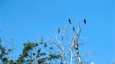
The Vistula River mouth is of significant natural significance. In 1991, the Mewia Łacha Nature Reserve was established on both sides of the canal. The conservation objectives in the reserve are the breeding grounds of various species of terns and the feeding and resting habitats of waders and anseriformes.
Hike recorded on August 10, 2025.