Virtual hike: Ascent to Romanka Mountain from Żabnica, Poland
Route: Żabnica Skałka (614 m a.s.l.; 49.562193, 19.192139) – Słowianka Tourist Station (846 m a.s.l.; 49.578175, 19.214044) – Suchy Groń (868 m a.s.l.; 49.571967, 19.221367) – Romanka Mountain (1366 m a.s.l.; 49.560752, 19.241923) – Majcherkowa Mountain (1358 m a.s.l.; 49.565651, 19.247586)
Trail designation: black trail, blue trail
Length: about 7.6 km
Walking time: about 3:00 h
Sum of approaches: 790 m
Sum down: 53 m
00:00:17 Żabnica Skałka
00:01:21 Suchy Stream
00:02:26 Suchy Stream
00:47:33 Słowianka Tourist Station
00:47:46 Crossing of trail
01:02:22 Going off the trail
01:05:16 Suchy Groń
01:11:07 Return to the blue trail and the red trail
01:12:46 Crossing of trails
01:56:00 Romanka Reserve
02:05:03 Romanka Stream
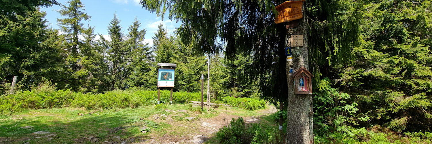
02:27:41 Chapel
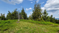
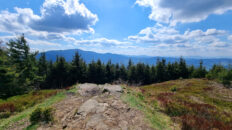
02:28:01 Romanka Mountain
02:29:04 Crossing of trails
02:40:17 Going off the trail
02:41:09 Majcherkowa Mountain
Romanka Mountain – a peak at 1366 m a.s.l. in the Żywiec-Orawa Beskid Mountains. It is the highest peak in the Lipowski Wierch and Romanka Group. To the northeast, it borders the twin peaks of Majcherkowa Mountain and to the south, via the Pawlusia Pass, Rysianka Mountain. The western slopes descend steeply to the Romanka Stream valley, while the eastern slopes descend steeply to the Sopotnia Stream. Romanka serves as a keystone for two ridges. To the northwest, a ridge branches off Romanka, leading to Skała Mountain, and to the northeast, a second ridge leads to Kotarnica.
Romanka is composed of Carpathian flysch, alternating layers of sandstone and shale, folded during the Cenozoic era during Alpine mountain formation. These deposits were formed on the seabed, and their uplift formed the present-day mountains. The high resistance of the cemented transverse fault zones resulted in the formation of transverse ridges, rather than valleys. The relief of these ridges is the result of selective processes occurring in this area during the Pleistocene, and the slopes of the range are occupied by numerous deep structural rock slides.
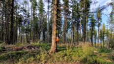
The summit and slopes of Romanka are almost entirely covered with forest. The upper montane spruce forest on the western slopes begins at an elevation of approximately 1,150 meters above sea level, and on the eastern slopes at approximately 1,200 meters above sea level. For its protection, the Romanka Nature Reserve was established in 1963. It encompasses the summit areas and covers an area of nearly 125 hectares. The reserve boasts impressive spruce trees, some 250 or even 300 years old. Currently, the spruce stand is being intensively attacked by the bark beetle, causing large swaths of trees to die. The lower slopes of Romanka are covered by a lower montane mixed forest, consisting primarily of beech, fir, sycamore, and rowan. The main forest communities occurring here are the lower montane fir-spruce forest and the acidophilous mountain beech forest.
As a result of centuries of human activity, several clearings have been created in the Romanka massif, used as pastoral pastures: the Wieprzska Pasture, the Łyśniewska Pasture, and other smaller, now unnamed meadows.
The blue Żywiec-Bystra Górna hiking trail and the yellow Rajcza-Romanka hiking trail lead through the summit.
Hike recorded on June 5, 2025.