Virtual hike: Ascent to Čertův Mlýn Mountain from Kunčice pod Ondřejníkem, Czech Republic
Route: Kunčice pod Ondřejníkem, Pod Stolovou – koliba (589 m a.s.l.; 49.522028, 18.308223) – Pod Stolovou – intersection (594 m a.s.l.; 49.519377, 18.309994) – Malá Stolová – intersection (952 m a.s.l.; 49.508000, 18.311151) – Velká Stolová (1056 m a.s.l.; 49.510381, 18.301273) – Folvark (1060 m a.s.l.; 49.504682, 18.307683) – Kněhyně – sedlo (1142 m a.s.l.; 49.493963, 18.304467) – Čertův mlýn (1206 m a.s.l.; 49.489153, 18.301639) – Čertův stůl (1196 m a.s.l.; 49.488424, 18.301874)
Trail designation: yellow trail, red trail
Length: about 6.7 km
Walking time: about 3:00 h
Sum of approaches: 641 m
Sum down: 33 m
00:00:19 Kunčice pod Ondřejníkem, Pod Stolovou – koliba
00:04:23 Pod Stolovou – intersection
00:07:31 Stolovec Stream
00:09:17 Stolovec Stream
00:10:36 Stolovec Stream
00:16:48 Stolovec Stream
00:34:46 Stolovec Stream
00:42:02 Stolovec Stream
00:48:44 Leopoldka Spring
00:50:43 Chata Leopoldka
00:54:40 Malá Stolová – intersection
00:57:51 Going off the trail
01:24:29 Velká Stolová
01:47:42 Folvark
01:53:57 Return to the red trail
01:54:58 Kněhyně – Čertův mlýn National Nature Reserve
02:25:00 Kněhyně – sedlo
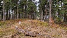
02:27:22 Remains of the Greiffka hunting lodge
02:38:07 Čertův mlýn
02:44:39 Čertův stůl
Čertův Mlýn – a peak at 1206 m above sea level in the Moravian-Silesian Beskids in the Czech Republic, the fifth highest in this mountain range. It is located on the main ridge of the Radhošťská Hornatina, bordering Kněhyně Peak to the northeast and Skalka Peak to the west. To the south, a side ridge extends, with Bukovina Peak. The northern slopes descend into the Bystrá River valley, the southwestern slopes descend into the Kněhyně Stream valley, and the eastern slopes descend into the Kněhyňská Ráztoka valley.
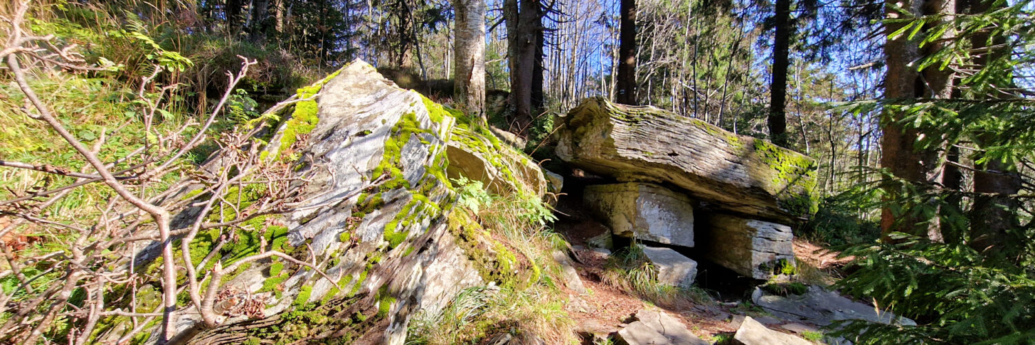
Čertův Mlýn is composed of massive beds of Godula sandstone. The summit sections and the southern ridge contain several rocky outcrops, outcrops, and clefts. A meridianally extending rocky gully, approximately 50 meters long, extends on the southern side of the peak. Beyond the gully is the Čertův stůl (Devil’s Table), a dolmen-shaped rock formation. The stone slab, weighing approximately 6,500 kg, rests on two stone plinths. The entire set of stones resembles a table, the origin of which is unclear. It is unknown whether this formation is natural or man-made.
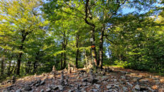
The summit and its slopes are covered with forest. In the summit sections, these are fragments of the spruce forest of the upper montane zone, while the slopes are covered with a mixed forest of the lower montane zone, dominated by beech and sycamore. The summit offers no views.
At the summit, the red and green hiking trails intersect.
The hike recorded on October 3, 2025.